

B is for… bridge
Our new series of posts helping you to explore our county is an A-Z of Bedfordshire places, landscapes and history. Each post will include tips for walks and places to visit.
Bridges are an often overlooked feature of the landscape, they tell us about the history of the area, connections between people and places, trade routes and much more.
The River Great Ouse loops through North Bedfordshire, taking 46 miles to cross a county with a width of only 18 miles at this point. In this feature we follow it from Turvey to Great Barford, pausing at a handful of the many crossing points.
Turvey
A boundary stone on Turvey Bridge marks the dividing line between Bedfordshire and Buckinghamshire. The earliest record of a bridge here dates from the 1130s when Sampson Fortis granted two acres of meadow by the bridge to Harrold Priory.
Like many medieval bridges, it wasn’t just a place to cross the river. In 1272 justices travelling from Northampton to Bedford stopped at the bridge to hear four cases. The bridge was also home to a hermitage and chantry chapel. In early Christianity, a hermitage was a place where religious men lived on their own to escape the temptations of the world. Chantry chapels were manned by a chaplain whose role was to say mass for the souls of the dead to reduce their time in purgatory. They also collected alms which helped pay for the upkeep of the bridge. Chantry chapels were closed during the Reformation and were either destroyed or put to other uses – the one on the bridge in Bedford became a lock-up for the temporary detention of criminals.
In 1928 the Highways Committee approved a widening scheme to help manage the increased road traffic, which was completed in 1932 at a total cost of £16,000. In 1933, H C Griffin of The Council for the Preservation of Rural England (now CPRE, the countryside charity) wrote to The Times:
Harrold
The earliest crossing point at Harrold was a ford, part of an ancient route connecting Pavenham and Chellington to Irchester. By the twelfth century there was a bridge, providing an important communication route between Bedford and Northampton, with a significant impact on the surrounding villages and local roads. The bridge spanned the river and the floodplain meadows, keeping access open in all but the most severe floods. A foot causeway ran in parallel with the road.
Wills and account books are fascinating sources of information for local history. Sixteenth century wills show bequests made for the upkeep of the bridge, while bailiffs accounts from the 1530s show the amounts paid for jobs such as felling, sawing and laying timber planks. As the benefits of the bridge were shared between a number of villages, several lords of the manor and their tenants contributed to putting the bridge up and keeping it in repair. In a period where responsibility for repairs was often contested this is a nice example of people working together.
Bromham
The 26 arches of Bromham Bridge look medieval but were largely rebuilt in 1813, however there has been a bridge there since at least 1224. A watermill has probably occupied the site near the bridge since before the Domesday Survey of 1086. The medieval river was rich in eels which provided a substantial additional income for the miller.
Occasionally we get glimpses of national as well as local history. During the English Civil Wars (1642-1651) Henry Lowens tried to obstruct the Parliamentary soldiers by putting a chain across the bridge. In Bedford, there was even fighting on the bridge.
Records of accidents are an interesting source of information about bridges, in 1281 a long spell of freezing weather caused Bromham Bridge to give way and a woman was carried away on an ice floe. Accidents involving horses and carts were noted on Harrold Bridge in the 1840s.
Bedford – Butterfly Bridge
This pedestrian bridge across the Great Ouse in Bedford is the result of a competition launched in 1996 to mark the end of the twentieth century and the new millennium. The 79 entries were whittled down to the winning design from Wilson Eyre Architects.
The competition brief referred to Webster’s 1888 suspension bridge, only a few hundred metres downstream, described as a ‘memorable landmark which epitomises Bedford at the end of the 19th century’. The 1888 bridge connected the Embankment to Mill Meadows and was designed to allow sailing boats to pass underneath. A large part of the £500 cost was funded via public subscription. The Embankment dates from the Victorian period and provided opportunities for nineteenth century town dwellers to enjoy fresh air and exercise along a tree lined promenade. Leisure was centred on the river with boats, regattas, fetes and pageants forming part of the life of the town.

Bedford – Town Bridge
The bridge at Bedford has been important in the history of the rise of fall of the town’s trading fortunes. As early as the 1440s the old bridge was cited as a reason for the loss of trade and so improvements needed to be made to make the river navigable to Bedford, which eventually happened in 1689. This was done as part of an age of river improvements across the country between 1600-1750, and it had an immediate impact. Along the riverfront shops, yards and wharfs sprang up and Bedford became a local hub for the distribution of coal from Newcastle. Other goods unloaded in the town were those required by an inland agricultural region including fish, salt, iron, grindstones, timber, pitch and hempseed. Brewers were also attracted to the riverside sites. Watermen who steered the boats and horsemen who managed the towing horses were doing thirsty work and visited the local pubs.
The bridge we see today replaced a narrow predecessor and was opened in 1813. Tolls were charged until 1835 when the cost of building it had been recouped for investors. By the 1860s river traffic was in decline as trade switched to the railways. The bridge was widened between 1938-40 to cope with the increase in motor traffic for both transporting goods and leisure.

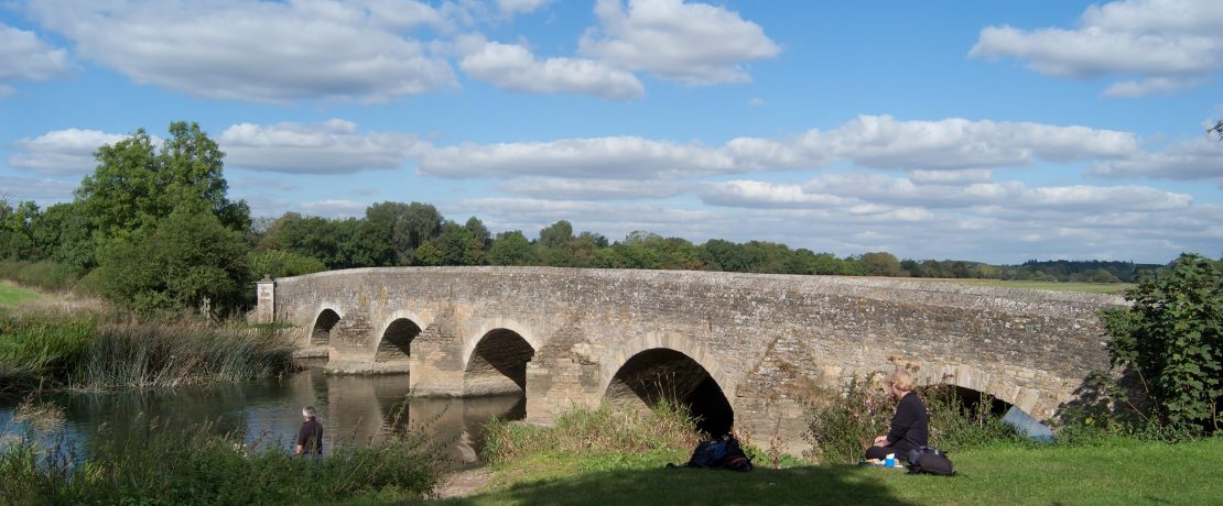
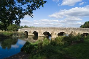
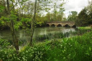
Great Barford
Before the river became navigable to Bedford, Great Barford was the head of the navigation and was as busy with trade related activity as Bedford was to become. As Bedford’s fortunes rose, Great Barford’s declined. Today the fifteenth century bridge and causeway with its 17 arches is Grade I listed and sits in a peaceful riverside landscape.
The road crossing the bridge was made into a turnpike in 1772. This meant that tolls were charged for using the road and some of the money raised was used to repair the road, the bridge and culverts. Turnpike Trusts were set up by Acts of Parliament. By the 1830s, over 1,000 trusts administered around 30,000 miles of turnpike road in England and Wales, taking tolls at almost 8,000 tollgates and sidebars. Sidebars were introduced to catch out farmers who only used sections of the road between turnpike gates.
After Great Barford, the river flows on into Cambridgeshire through St Neots.
Exploring for yourself
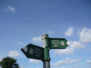
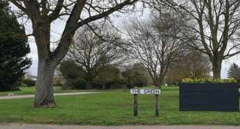
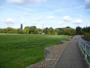
For those looking for a challenge, the Ouse Valley Way is a long-distance source to sea walking route. However, it’s easy to visit the bridges mentioned here by exploring their villages or strolling down the Embankment in Bedford. Harrold-Odell Country Park is a good base from which to see Harrold Bridge and the village’s other historic features. The John Bunyan Community Boat offers a way to see some of the river’s bridges from a different angle.