

Discover: Leighton-Linslade
The town of Leighton-Linslade was formed from the two towns of Leighton Buzzard and Linslade. Linslade was originally in Buckinghamshire and was transferred to Bedfordshire in 1965 when the towns were amalgamated.
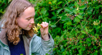
There are lots of walks and trails to help you explore the area – whether you’re interested in history, wildlife or keeping the children entertained, there’s something for everyone.
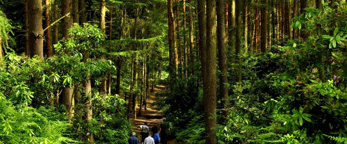
Rushmere Country Park
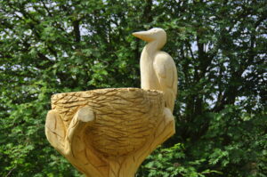
Rushmere Country Park is managed by the Greensand Trust. It’s home to woodland, heathland and meadows which means there’s a huge variety of wildlife to spot. Much of area was historically heathland, traditionally managed for sheep grazing and the cutting of gorse and heather for fuel. Sand was also dug for local building purposes. By the 1940s there were commercial conifer plantations on most of the heathland, but it is now being restored by the Greensand Trust to provide habitats for adders, lizards, birds like tree pipits and woodlarks. The Heronry is home to around ten pairs of breeding birds each year which can be watched via remote cameras or binoculars. Facilities include toilets, cafe, trails for walkers, cyclists and horse riders, and play spots for younger visitors.
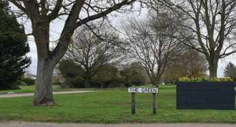
Heath and Reach
Heath and Reach was originally two separate hamlets. The Heath part of the name refers to local landscape of sandy heathland but the Reach part is more obscure, with no clear consensus on where it came from. (See the Community Histories section of the Bedfordshire Archives for some speculation!)
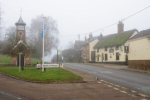
The Stockgrove entrance to Rushmere Country Park can be found in Heath and Reach. (Stockgrove Country Park is now part of Rushmere Country Park.) The historic Stockgrove Estate has a history dating back to medieval times. The ornamental lake was enlarged between 1929-39 and is one of the park’s most distinctive features.
Start of the Greensand Ridge Walk
The Greensand Ridge Walk is a long-distance walk of around 40 miles. It starts in Leighton Buzzard, running north-east towards Sandy and Gamlingay. It follows the Greensand Ridge a landscape of gently rolling hills and small valleys, often heavily wooded and rich in wildlife. Stretch one runs for 8.5 miles from Leighton Buzzard to Woburn.
Leighton-Linslade
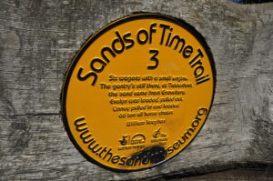
Leighton-Linslade is home to three walking trails. The Sands of Time Trail celebrates the memories of people who have lived and worked in the area. There are nine plaques to discover, supported by 33 audio interviews. Together they tell the personal stories of local people who worked in the sand industry’s quarries, wagons and railways. Other stories are of village life, childhood, archaeology and wildlife.
The Living History Trail covers the town centre. It tells the stories of 12 people from the town’s past. One of those is Thomas Tucker. He was a teenage thief who sparked a manhunt in 1839, eventually he was arrested in a Leighton Buzzard alley. The 16 year old chimney sweep was sentenced to ten years ‘transportation’ for stealing a silver watch and money. Transportation involved relocating the criminal to faraway colonies – mostly Australia. Tucker was taken to Woolwich and placed aboard the Warrior Hulk, a floating prison ship. Few prisoners ever made it back home. There is a leaflet and app to help you follow the trail.
The Children’s Trail is being refreshed for 2024. It features 22 artworks celebrating children’s stories. The Children’s Trail is partly inspired by the books of Mary Norton, who lived in the town as a child and set The Borrowers in The Manor House, now Leighton Middle School. Free challenge-based activity maps can be downloaded to help engage young explorers.
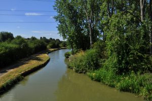
The Grand Union Canal
The stretch of canal through Linslade, linking Fenny Stratford in Buckinghamshire with London, opened in May 1800.The canal was then known as the Grand Junction. The Linslade section of the canal included several wharves which served the sand quarries of Heath & Reach.
Other canal-side industries included limekilns, coal and grain merchants, engineering companies, haulage and packet boat companies as well as the administrators of the canal such as wharfingers (wharf owners / keepers), lockkeepers, canal police, lengthmen (employed to maintain sections of canal) and toll clerks.
Today the canal at Leighton-Linslade is part of the Grand Union canal and you can enjoy walks along the towpath.
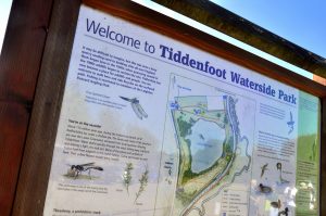
Tiddenfoot Waterside Park
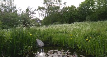
The lake at Tiddenfoot was formed from a former sand quarry and is now a haven for wildlife. The walk round the lake is about a mile long, look out for water birds such as tufted ducks, mute swans, great crested grebes, coots and moorhens, as well as for amphibians and invertebrates. The trees, shrubs and hedgerows provide food, shelter and nesting sites for another range of birds including blue-tits, blackcap and willow warblers. You can access the canal towpath from the park.
Linslade Wood
Linslade Wood consists of two areas of woodland. Bluebell Wood is a County Wildlfe Site and semi-natural ancient woodland. Records show that the woodland has been in existence since 1602, and likely dates back much further. It’s a wildlife rich site, home to birds, animals, woodland flowers and a range of native trees. The newer woodland is more open and provides a habitat for butterflies, lizards and flowering plants. A video from the Greensand Trust introduces the site:
Ouzel Valley Meander
Leighton Buzzard is home to the Ouzel Meadows, these flood regularly in autumn and winter but are dry throughout the summer and support a wide range of plants, birds such as kingfishers and herons, and bats. The seasonal flooding creates a special habitat where damp meadow species can thrive. There are a number of tracks across the meadows with links to neighbouring footpaths and the Grand Union Canal towpath.
Read more and download a leaflet with a map of the meadows.