

O is for Ouse Valley
Our series of posts helping you to explore our county is an A-Z of Bedfordshire places, landscapes and history. Each post includes tips for walks and places to visit.
This time we turn to the landscape of the Ouse Valley in the north of the county.
Geology
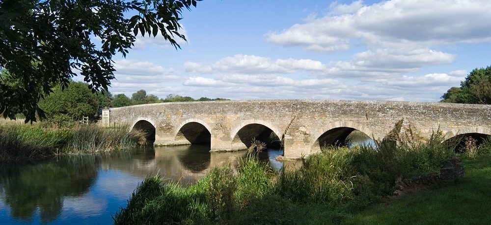
The distinctive look of the pretty villages that line the northern reaches of the Great Ouse comes from the local limestone used as a building material. Churches, bridges and houses in villages like Harrold, Odell, Stevington and Pavenham are made from this oolitic limestone. Their story starts in the Jurassic period around 200 million years ago, when the area was covered by warm shallow seas which were full of marine life. Tiny spheres of calcium carbonate known as ooliths were formed by the currents collecting layers of lime around a tiny core of sand or broken shell. Other, larger fossils, including ammonites and sea urchins can also be found in the limestone.
The area was also shaped by the presence of stony soil known as combrash, which was good for growing crops like wheat and barley. The fertile, well-drained soil made it possible to settle and farm along the river valley.
Lives in the landscape
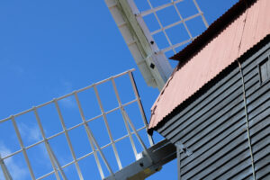
Mills sprang up along the river to grind the corn grown in the nearby fields. The Domesday Book of 1086 lists mills in villages including Bromham, Turvey, Pavenham, Odell, Harrold, Felmersham and Milton Ernest. These were all watermills as windmills hadn’t yet been introduced. Millers would often supplement their income by trapping and selling eels. Of the many mills once in operation, only Bromham Mill still retains its machinery. The windmill at Stevington dates from the eighteenth century and is the only complete windmill left in Bedfordshire.
Other ways of earning a living from the river included harvesting willow for making baskets or fish traps, and cutting the rushes in the reed beds for thatch, floor coverings, furniture making or weaving. The stretch of the river around Pavenham became particularly known for rush gathering thanks to the horseshoe loops that gave plenty of reed beds within a relatively small area. Between June and August, the men would wade into the water, cutting the rushes with a long hand-held bill hook. They would sleep in tents nearby while the bundles were transported by river or cart and laid out to dry. Today the Pavenham Osier (osier is a type of willow) Beds are managed as a nature reserve by the Wildlife Trust.
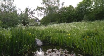
Water meadows
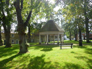
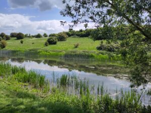
One of the most important wildlife habitats in the Ouse Valley are the water meadows, rich in wildflowers, small mammals and butterflies. Situated next to rivers, they now seasonally flood but were originally artificially flooded grasslands, managed to improve pasture quality by controlled irrigation. Historically, they were used in Bedfordshire and across England for winter and early spring grazing and haymaking, benefiting from the nutrient-rich silt deposited by the flooding. They are now semi-natural wet grasslands and floodplain meadows. At Harrold-Odell Country Park you can see cattle grazing in the water meadows between April and November. Fenlake Meadows on the edge of Bedford also have a long history as grazing meadows and are a Local Nature Reserve.
Today’s river
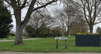
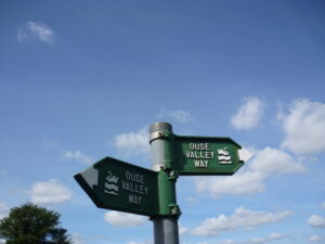
The river today is home to otters, kingfishers and other wildlife and attracts nature watchers. It’s also popular with boaters, kayakers and others for sport and leisure. The Ouse Valley Way Long Distance Path caters for walkers and there are plenty of parks and green spaces to enjoy along the way.
The Bedfordshire Great Ouse Valley Environmental Trust (BedsGOVET) run a volunteer led citizen science project, monitoring the pollution in the river. This is helping to identify key pollution sources and spearhead work to make the Great Ouse cleaner and healthier.
Read more
If you enjoyed this post, you might also like C is for Chalk which explores the landscape of the Chilterns and B is for Bridge which follows the river from Turvey to Great Barford, stopping at some of the many crossing points.
Exploring the Ouse Valley
Priory Country Park information and trail leaflets
Pavenham Osier Beds – Wildlife Trust BCN
Bromham and Stagsden circular walk (6 miles)
The Ouse Valley Way Long Distance Path
Great Ouse Ways – covers the whole river
Citizen Science with BedsGOVET